Lake to Lake by Bike: The Berry Junction Trail from Muskegon Lake to White Lake
Twice in two days this July, I met riders who had hauled their bikes across the state to ride a trail that starts in our backyard. In the Muskegon Lake Nature Preserve parking lot, it was a couple in their seventies who had brought their e-bikes from Ann Arbor. The next day, out on the trail itself, it was two riders from Holland who told us nothing near Lake Macatawa compares. One of them put it in a sentence: "I couldn't believe the trail was like this the whole way."
They were all here for the Fred Meijer Berry Junction Trail, the paved route locals just call the lake-to-lake ride: Muskegon Lake at one end, White Lake at the other, and woods for most of the miles between. We rode it end to end for the first time this week, on new e-bikes, and came home with the details: where it starts, where to stop, and why people keep trailering bikes here to ride it.
Last reviewed August 2026. Trail conditions and amenities change; the Friends of the trail post current notices on their site.
Quick Facts
- Route
- Muskegon Lake at the Nature Preserve in North Muskegon to White Lake at Whitehall
- Trail length
- About 11.5 paved miles per the Friends group; the northern 7 are the old rail grade
- The full ride
- Roughly 15 miles one way; our out-and-back came to about 30
- Surface
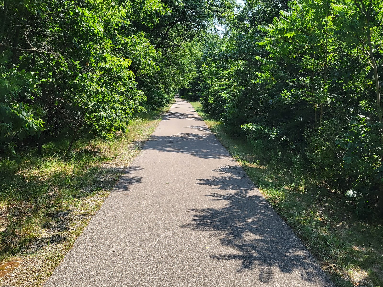
- Smooth asphalt the whole way, wide enough to ride side by side
- Where to park
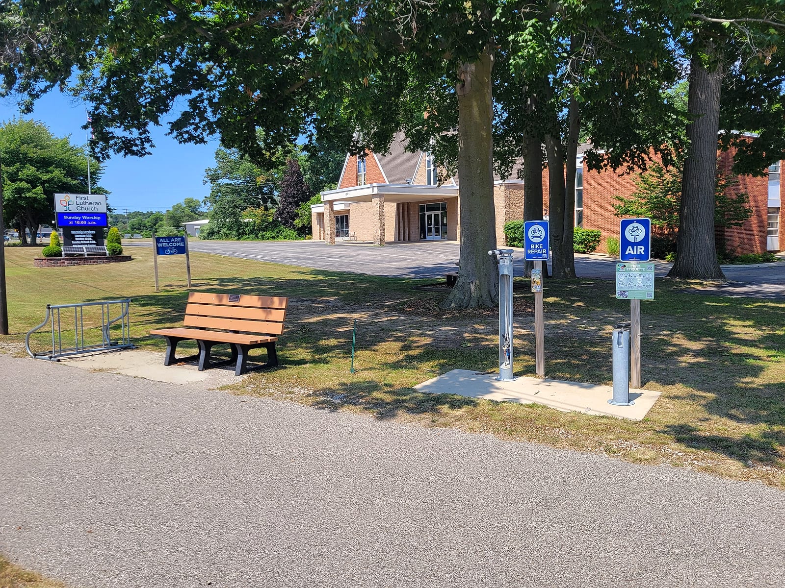
- First Lutheran Church, 1206 Whitehall Road - paved trailside lot half a mile up; our pick over the preserve's gravel lot
- Rest stops
- The church stop, a creek-side bench and picnic table in the woods, and a coaster-watching bench at the Michigan's Adventure fence
- Connects to
- Muskegon Lakeshore Trail to the south; White Lake Pathway and the Hart-Montague Trail to the north
The Ride, South to North
The ride starts where the pavement does, at the Muskegon Lake Nature Preserve on Lake Avenue in North Muskegon - the Friends of the Berry Junction Trail list the preserve as the trail's south trailhead, with a gravel parking lot. The preserve deserves a slow lap of its own before you clip in: an all-volunteer nonprofit, the Muskegon Environmental Research and Education Society, keeps this stretch of marsh and forest where the Muskegon River meets the lake, with a wetland trail and a quarter-mile river walk. It also sits next door to the North Pier condos, whose guide covers what living beside the trailhead looks like.
From the preserve, a wide paved path climbs gently along the Whitehall Road corridor through North Muskegon. At the Fifth Third Bank corner there is a dedicated push-button crossing for bikers and walkers; press it, cross with the signal, and the path continues north past First Lutheran Church and into the trees. That church stop gets its own section below, because it earns one.
North of the church, the path bends east and enters the woods. This stretch is the 4.6 miles the Friends group added in 2018, and it hides the trail's namesake: where the path crosses River Road, Berry Junction itself sits about thirty feet away - the junction where the line out of Muskegon split toward Pentwater and White Cloud, per the Friends' history. At McMillan Road you pick up the true rail-trail: seven miles of old railroad grade, flat, straight, and wooded, running to White Lake Drive through the pine and oak country the corridor's trains once worked. The White Lake area's visitors bureau traces the corridor back to the Chicago and West Michigan Railroad, and the grade is why those miles ride so easily; locomotives did not climb hills, and neither will you.
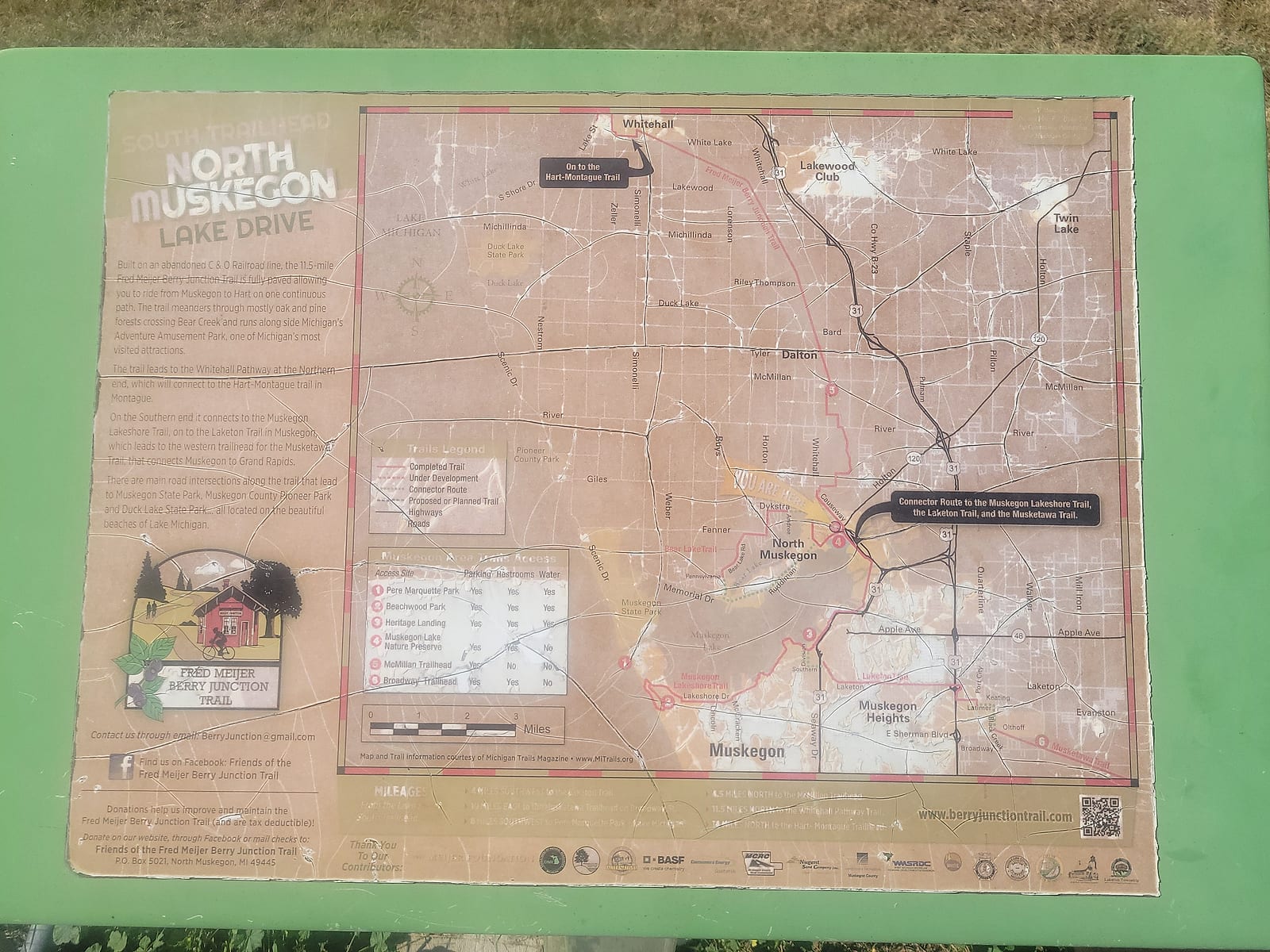
There is one loud neighbor. Near Riley Thompson Road, about midway, the trail passes Michigan's Adventure close enough that Shivering Timbers, the big wooden coaster, towers over the trail - the visitors bureau's description, and an accurate one. Better yet, a bench sits by the park's tall metal fence right where one of the coasters rounds its corner high overhead, and it makes a fun break: sit for a few minutes, watch a train full of screaming riders sweep through the turn above you, and then let the woods swallow the sound again as you pedal on. Map boards posted along the way keep you oriented through the townships in between.
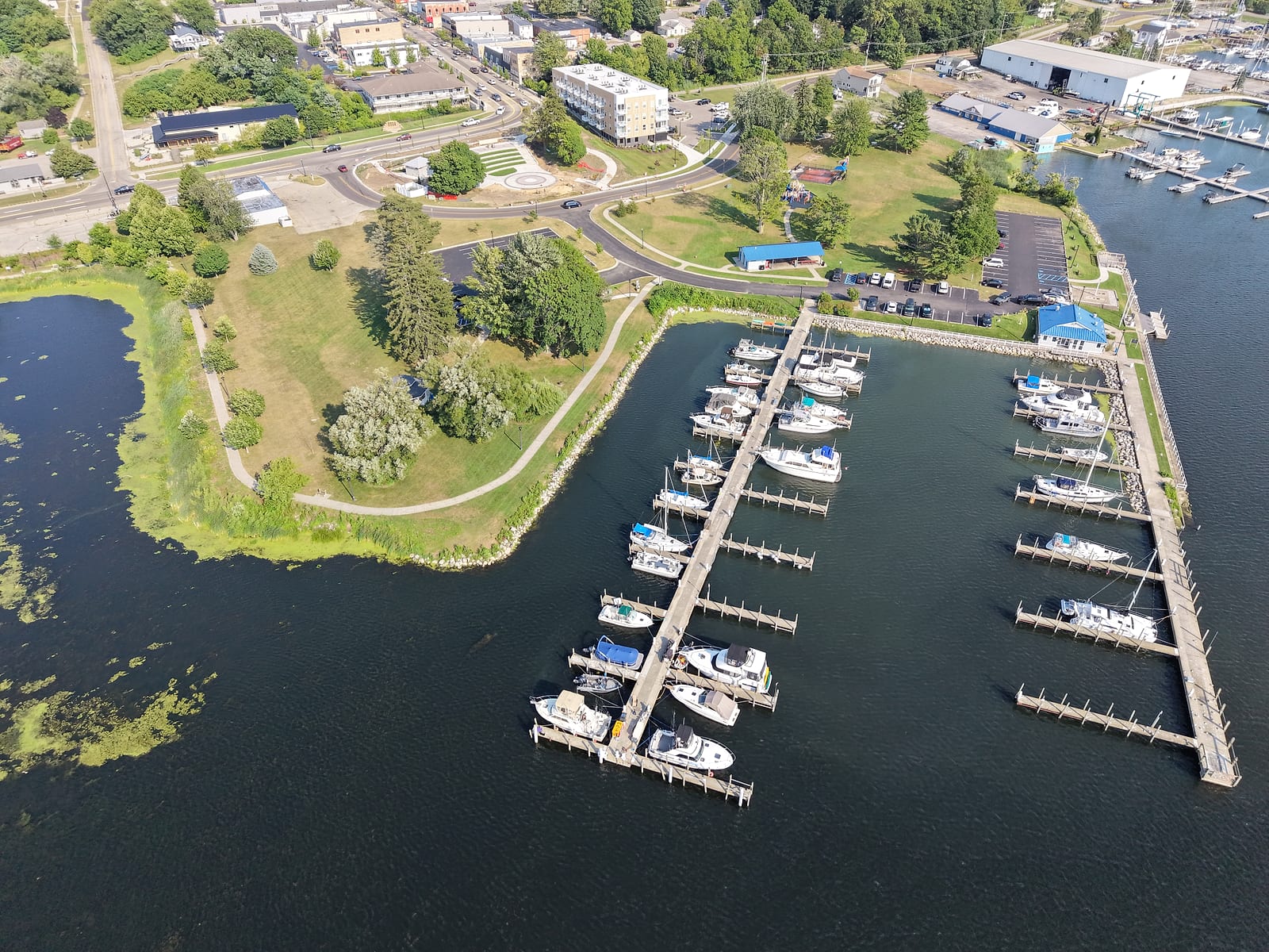
At White Lake Drive the rail-trail ends and hands you to the White Lake Pathway, which the visitors bureau describes as continuing about three miles through Whitehall toward Montague. Downtown Whitehall and the water are a short, easy ride in. Goodrich Park sits beside the White Lake Municipal Marina with a playground, picnic tables, and open views of White Lake: the lake-to-lake payoff, one lake behind you and another at your front wheel. Anyone still fresh can keep going - from Montague, the William Field Memorial Hart-Montague Trail State Park, Michigan's first paved rail trail, runs another 22 miles north to Hart.
Call it about fifteen miles from the preserve to the White Lake waterfront. Our first ride, with a long lunch stop, came out right around thirty miles round trip. On e-bikes it made for an unhurried afternoon; on leg power alone, treat it as a real ride and bring water.
A Church That Welcomes Riders
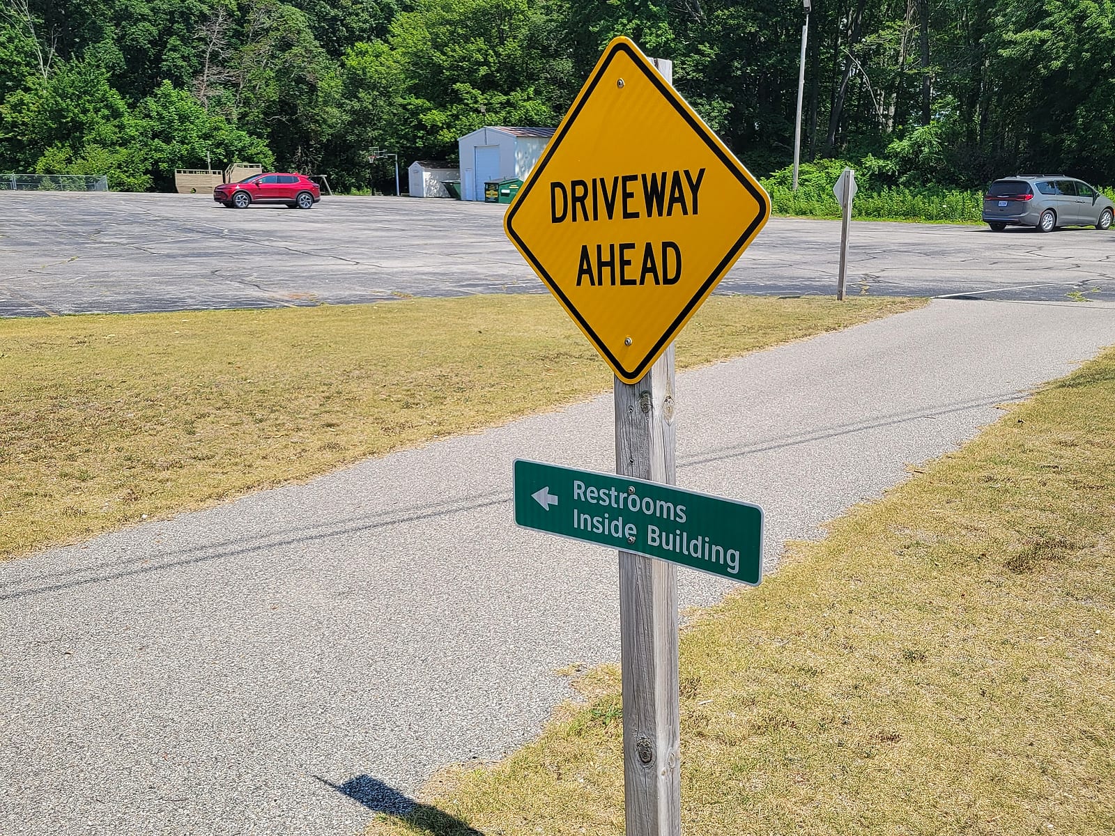
About half a mile up from the preserve, where the path passes its front lawn on Whitehall Road, First Lutheran Church has quietly built the best rider stop on the route. The Friends group's trailheads page lists the church as additional parking: plenty of paved parking, a bench, a picnic table, and a bike rack. What the listing undersells is the welcome itself. When we rolled through in July 2026, the church's own signs at the path spelled it out: All Are Welcome with a bicycle on it, a public air pump, a bike repair stand with tools, water, and a green sign riders remember - Restrooms Inside Building, useful whenever the building is open.
It also settles the parking question: when visitors ask where to leave the car, we point them here instead of the preserve. The lot is paved instead of gravel, it sits right on the path, and the restrooms inside seal it. Heading north to White Lake, park here and just ride - no sense pedaling the wrong way first only to pass your own car on the way back through. If you want to touch Muskegon Lake too, save the half-mile spur down to the preserve for the end of the day, when it makes a nice cooldown.
Rest Stops and How the Trail Rides
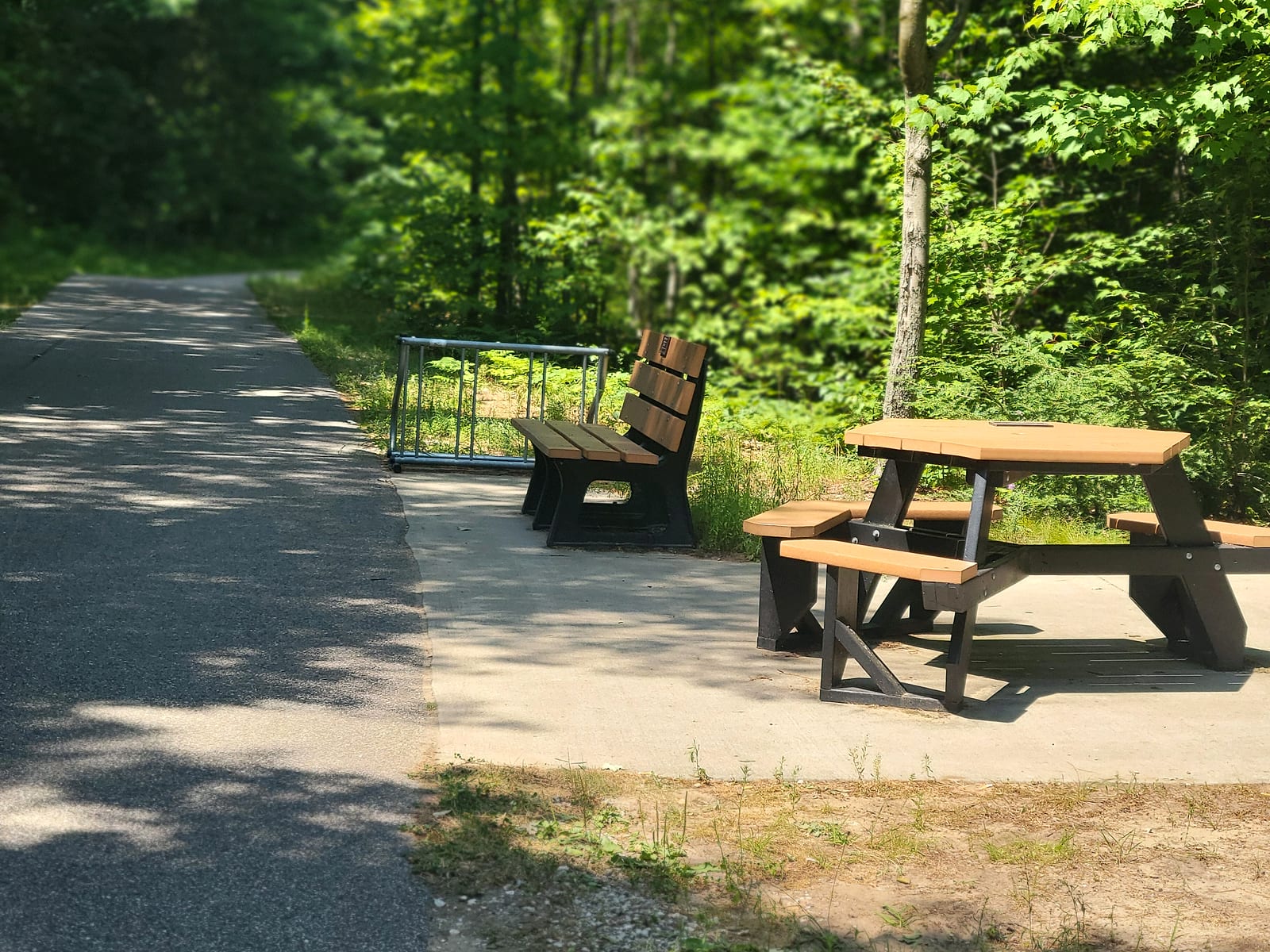
The pavement is the story the visiting riders kept coming back to. It is smooth, wide asphalt with clean edges and mowed shoulders, consistent from the preserve to Whitehall - what you see in the photos here is what the whole route looks like. We bought our e-bikes days before this ride, and the trail is exactly what a first long e-bike ride wants: flat, shaded, and free of car traffic outside a handful of road crossings.
Rest stops are built in. Partway up, a bench and a picnic table sit on a concrete pad beside the path, with a bike rack and a creek sliding past that feeds Bear Lake - moving water and deep shade, better than most highway rest areas. Between that, the church stop, the coaster bench at the Michigan's Adventure fence, and the parks at the Whitehall end, you are never far from a place to sit.
The company on the trail tells you something too. In one July ride we passed local walkers, road cyclists, and the two Holland riders who had trailered their bikes to North Muskegon specifically to ride to White Lake and back.
The White Lake End: Goodrich Park and Pekadill's
Every good ride needs a destination, and Whitehall delivers two. The first is the water itself: Goodrich Park beside the municipal marina, where White Lake opens up in front of you and the picnic tables come with a view. The second is lunch. A few blocks from the park at 503 South Mears Avenue, Pekadill's is a house turned sandwich shop, family owned since it opened in 1983 and run by the Dillivan family since 1989. The name is a splice of its founders, Pete and Kathy, and their dog Dillon; the shop tells the story itself.
You order your food and carry it out into the garden, and the garden is the point: umbrella tables tucked among flower beds, small waterfalls running, butterflies working the plants while you eat. Their ice cream parlor scoops more than 25 flavors of Michigan-made Hudsonville and Ashby's, which matters considerably more at mile fifteen than it would at mile zero. Fifteen miles of woods, a garden lunch, and fifteen miles home is a complete summer day by any measure.
If You Live Here, the Trail Is an Amenity
Listings around North Muskegon mention trail access in passing, and it undersells what is on offer: a paved, low-stress route from the neighborhood to two different lakes. From the North Pier condos, the south trailhead is next door. From most of North Muskegon and the Bear Lake side, the Whitehall Road path is minutes away by bike. Southbound, the network crosses the causeway to the Muskegon Lakeshore Trail along the city's shoreline - the Muskegon Lake guide covers that side - so one household can reach downtown Muskegon, Bear Lake, and White Lake without a car rack. The network reaches farther than one ride, too: from Montague the pavement continues north to Hart, and from the city's southeast side the Musketawa Trail runs 26 paved miles toward Walker on the northwest edge of Grand Rapids - though the DNR has a 12-mile stretch of it closed for reconstruction into late 2026.
Visitors pay for the ride in gas and trailer straps. If you live here, it starts at the end of your street. If the trail is part of why you are considering a move to this area, the relocation checklist is the practical next step - and before any waterfront purchase, the hidden-risks guide covers the questions a listing will not raise.
Common Questions
How long is the Fred Meijer Berry Junction Trail?
The Friends of the trail put the full route at about 11.5 paved miles between North Muskegon and the Whitehall area: a 4.6-mile stretch they added in 2018, from the Muskegon Lake Nature Preserve up to McMillan Road, then the original seven miles of rail-trail from McMillan Road to White Lake Drive. Riding the full lake-to-lake route, from the Muskegon Lake Nature Preserve to the White Lake waterfront in downtown Whitehall, runs closer to 15 miles each way once you add the connecting path through North Muskegon and the last stretch through Whitehall. Our out-and-back, with a lunch stop, came to about 30 miles.
Where should you park to ride the trail from the Muskegon end?
Park at First Lutheran Church, 1206 Whitehall Road - that is where we send visitors. The Friends group lists it as additional parking about half a mile up from the south end, the lot is asphalt rather than the preserve's gravel, and restrooms are available inside whenever the building is open. Riding north to White Lake, there is no need to backtrack to the very start first; if you want the full water-to-water version, add the half-mile spur down to the Muskegon Lake Nature Preserve at the end of the ride instead. The preserve's gravel lot on Lake Avenue in North Muskegon also works, and it puts you at the very start of the pavement.
Is the Berry Junction Trail paved, and what condition is it in?
Asphalt end to end. On our July 2026 ride the surface was well tended the entire way, tidy at the edges with the shoulders mowed. The riders we met who had trailered their bikes up from Holland said the condition surprised them more than anything else about the trail.
Are there restrooms along the Berry Junction Trail?
Plan around three spots. First Lutheran Church posts a Restrooms Inside Building sign where the trail passes its lot, and they are nice restrooms, too - the catch is that the building has to be open. At the north end, the Friends group lists restrooms at the Whitehall Library about a mile up the connecting pathway, and public restrooms at the Montague trailhead about two miles beyond that. Their trailhead list shows nothing in the wooded middle, so time your stops.
Can you ride from Muskegon Lake to White Lake on paved trail the whole way?
Yes, and that is why locals call this the lake-to-lake ride. Paved path leaves the Muskegon Lake Nature Preserve, runs up the Whitehall Road corridor with a push-button crossing at the Fifth Third Bank corner, becomes the Berry Junction Trail through the woods (the northern seven miles ride the old rail grade), and hands off to the White Lake Pathway into Whitehall. Riders who want more can keep going: from Montague, the Hart-Montague Trail adds another 22 paved miles north to Hart.
Sources
- Friends of the Fred Meijer Berry Junction Trail - the 11.5-mile length, the Berry junction history, and the trailhead and parking list including the preserve, the church stop, and the Whitehall Library and Montague restrooms (reviewed July 2026)
- Muskegon Lake Nature Preserve - the preserve's own description of its trails, river walk, and the volunteer nonprofit that runs it
- First Lutheran Church - name and address; the rider amenities are what we saw and photographed at the trailside in July 2026
- White Lake Area Chamber and Visitors Bureau - the Chicago and West Michigan Railroad corridor, the Michigan's Adventure passage, and the White Lake Pathway connection
- Michigan DNR: William Field Memorial Hart-Montague Trail State Park - the 22-mile paved continuation north from Montague
- Michigan DNR: Musketawa Trail - the 26 paved miles from southeast Muskegon to Walker northwest of Grand Rapids, and the 12-mile reconstruction closure into late 2026 (checked July 2026)
- Pekadill's - the shop's own history, name origin, garden, and ice cream lineup
- Pure Michigan: Goodrich Park - the park beside the White Lake Municipal Marina
Related Guides
Living in North Muskegon
The elevated town the trail passes through, and what living above the lake is like.
Read the guideBear Lake North Muskegon
The quiet all-sports lake fed by the creek you rest beside on the ride north.
Read the guideMuskegon Waterfront Relocation Checklist
Seasons, utilities, storage, and services - the practical side of moving to the water.
Read the checklistMuskegon Lake Living Guide
The lake at the trail's south end: living, boating, and the shoreline the Lakeshore Trail follows.
Read the guide