White Lake: Lakefront Living Between Whitehall and Montague
Last reviewed August 2026. Access rules, marina terms, and water conditions change - use the linked sources on this page to confirm current details before relying on them.
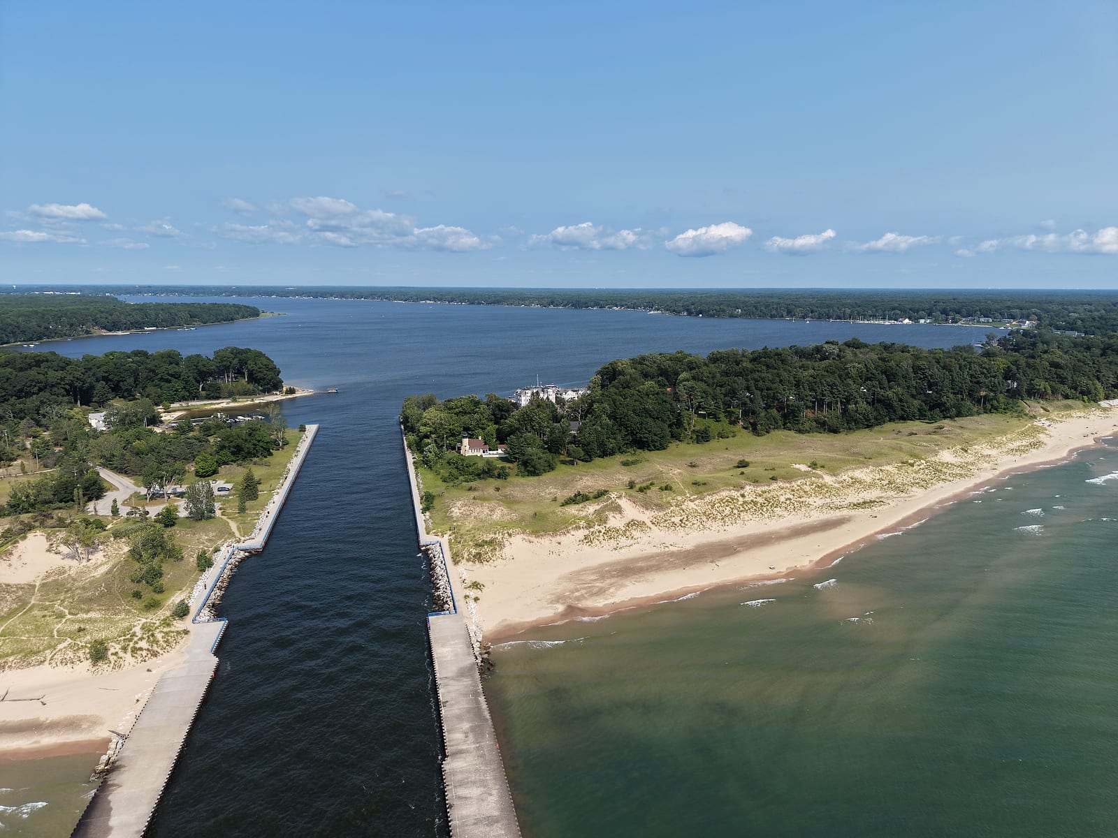
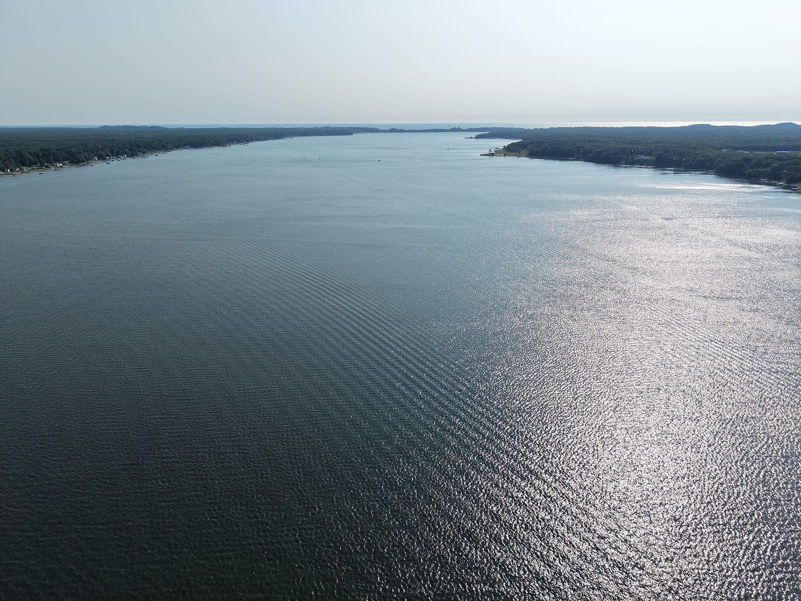
White Lake sits about twenty minutes up the coast from Muskegon, with the city of Whitehall along its south shore and Montague along its north. It is a drowned river mouth lake, the same kind of water body as Muskegon Lake: the White River flows in at the upper end, spreads across 2,571 acres, and drains to Lake Michigan through a channel a third of a mile long. If your search brought you here looking for the White Lake near Detroit, that is a different lake in Oakland County. This is the one on the Lake Michigan coast with two small cities facing each other across it.
I had a cottage on the Whitehall side about fifteen years ago, water out front and Montague across it. It was a cottage rather than our year-round home, which shaped what I know about the place: this is the lake we boated to, and the town we drove up to in the off-season when the summer crowd had gone home. What follows pairs that with what the state's current survey and cleanup records say about the lake.
Quick Facts
- Lake Size
- 2,571 acres
- Max Depth
- About 70 feet; about 23 feet average
- Dimensions
- About 5.5 miles long, a mile wide
- Lake Type
- Drowned river mouth; no-wake zones at both ends
- Connected To
- Lake Michigan via a federally maintained channel
- Main Inflow
- The White River
- Communities
- Whitehall (south), Montague (north)
- Main Launch
- Montague Municipal, annual permits only
- Best For
- Big-water access, small-town quiet, anglers
The Channel to Lake Michigan
The channel is the reason this lake punches above its size. Michigan's environment department describes White Lake as connected to Lake Michigan by a federally maintained navigation channel, and the DNR measures it at about a third of a mile between the lake and the big water. The Army Corps of Engineers dredges it to a 12-foot maintenance depth on a five-year cycle, classes the harbor as one serving recreational users, and calls it a harbor of refuge for this stretch of coast - the practical difference between here and a channel like Mona Lake's, where only smaller boats fit. What decides a boat here is its draft, its dock, and Lake Michigan's mood once you clear the piers.
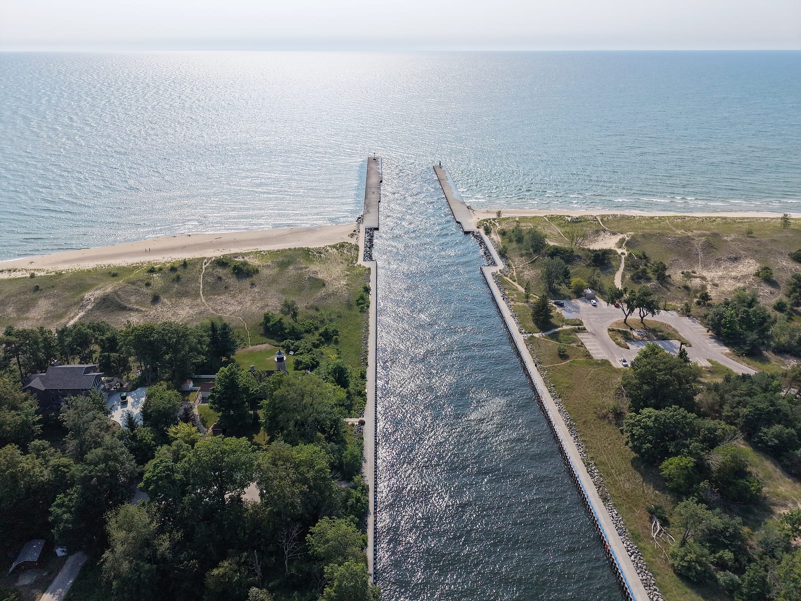
I used that channel a lot, in both directions. We would run the boat from our Muskegon Lake dock out the Muskegon channel, up the shoreline, and back in here to the cottage, and I made the same trip on a jetski - channel to channel in about twenty minutes on a calm day, holding forty. Over the years we gassed up by boat and ate at waterfront places that have since closed. It is a fine ride on the right day and a long, hard pounding on the wrong one, so the thing to read before you go is the wave forecast rather than the weather forecast - the habit is covered in the Lake Michigan shoreline guide.
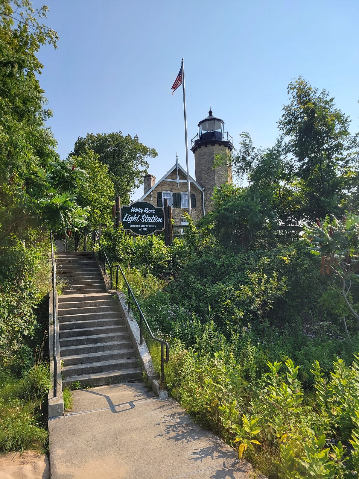
The piers themselves have a different culture than Muskegon's. On the Montague side, people jump off the pier into the channel all summer long, regularly enough that it reads as a local habit rather than an occasional stunt. Take that as observation rather than invitation - whether jumping is allowed is a question for the posted rules and the day's conditions, so check both before anyone in your group follows them in. Across the channel from them, on the Fruitland Township side, stands the White River Light Station, built in 1875, five years after the keepers' own history says the channel was dug. That cut replaced nature's route: the township's master plan places the old channel about a mile north of the present one, which was built to take larger ships. Its first keeper, Captain William Robinson, served 47 years there with his wife and thirteen children, and that same history credits a later keeper, Frances Marshall, as the last female lighthouse keeper in Michigan. It was decommissioned in 1960, opened as a museum in 1970 under the township's ownership, and has been managed by Lakeshore Keepers since 2012.
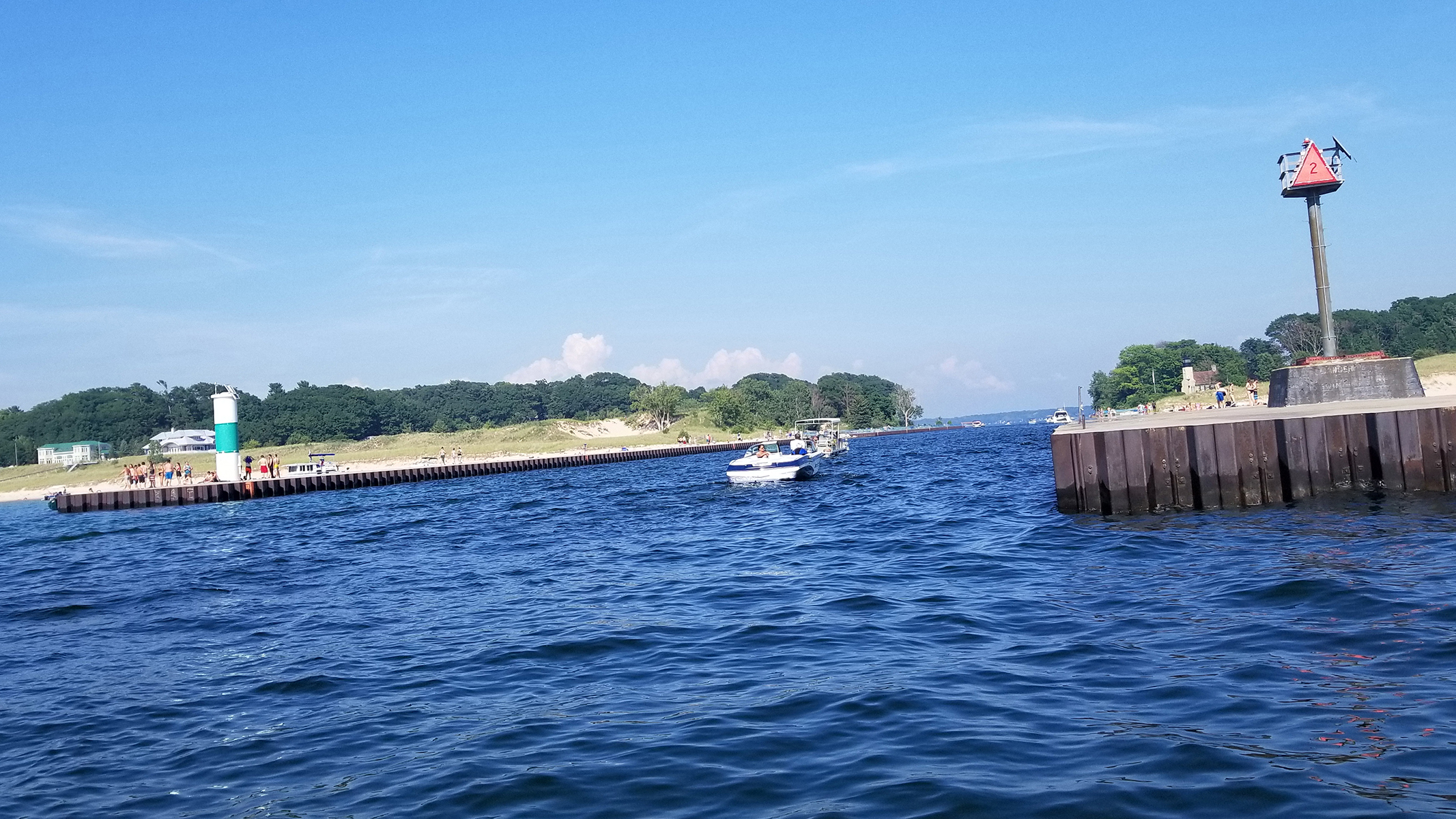
From the water in the channel, an older shot from my files: the crowd out on the Montague-side pier is the jumping culture in action, and it has looked like this for years. Boat traffic threads between the piers the whole time.
Boating: More Access Than Elbow Room
White Lake puts you onto Lake Michigan quickly - the federal cut is short - but Muskegon Lake gives you far more room to play inside. I would not take a jetski to White Lake the way I do on Muskegon Lake. Muskegon has open areas where you can run without thinking about it, and White Lake has fewer of them. The DNR's survey work explains why: the upper lake is heavily built, with large marinas occupying a substantial share of the lake's surface, and the White Lake Association installs no-wake buoys at the east and west ends. The open middle is the water you actually run in. Federal rules add a cap on the biggest boats: a Coast Guard regulation posted at the channel, 33 CFR 162.120, holds vessels over 40 feet to 8 miles per hour here - the same rule that covers Lake Michigan harbors from Grand Haven up to Petoskey, Muskegon included.
The counterweight to all that horsepower is canvas. The White Lake Yacht Club sits on the south shore, and its racing calendar fills summer weekends: scow, Laser, and keelboat fleets on Saturdays and Sundays, with the junior fleet out on Sunday mornings.
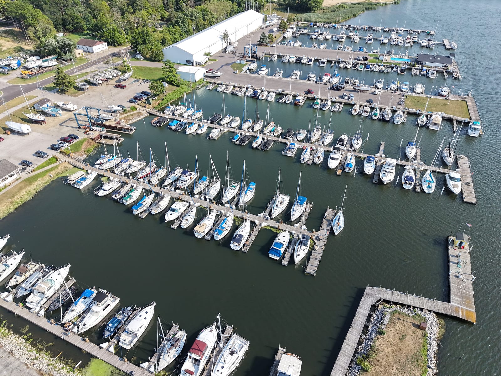
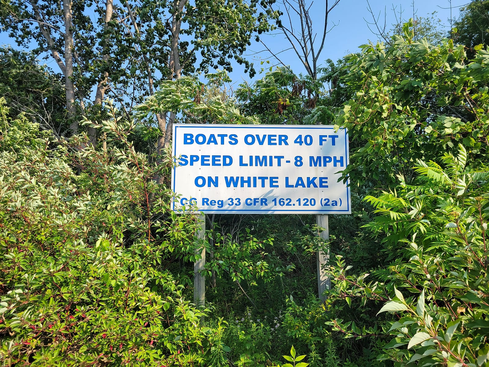
Crosswinds Marine Service, one of the large private marinas on upper White Lake - the DNR's survey notes how much of the upper lake's surface the marinas occupy - and the posted federal speed cap at the channel. July 2026.
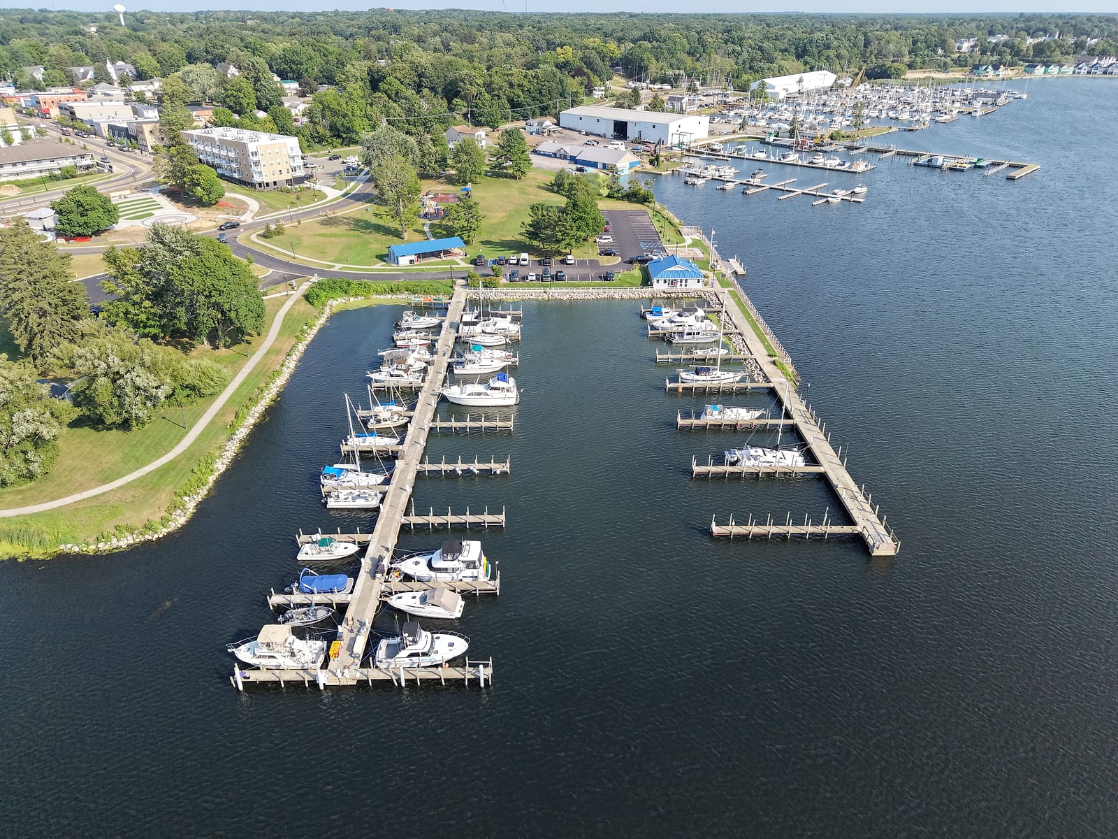
For getting on the water, the Montague Municipal Boat Launch at the upper end is the workhorse: the DNR calls it the primary launch on the lake, with parking for about 60 vehicles and trailers plus a fish-cleaning station. Read the permit rules before you tow anything up here, because Montague sells annual permits and states plainly that there are no daily ones. The only other ramps on the lake are small: Scenic Road on the south side and Lau Road on the north, each with parking for a few rigs. Whitehall adds one more just off the lake itself: Covell Park, on Thompson Street by the Dowling Street causeway, keeps a small ramp on the White River upstream of the lake - the city lists it as a fishing access with paved parking. For shore access without a boat, the DNR points to a string of Whitehall parks plus Maple Grove Park on the Montague side.
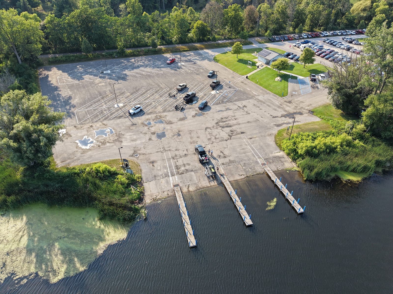
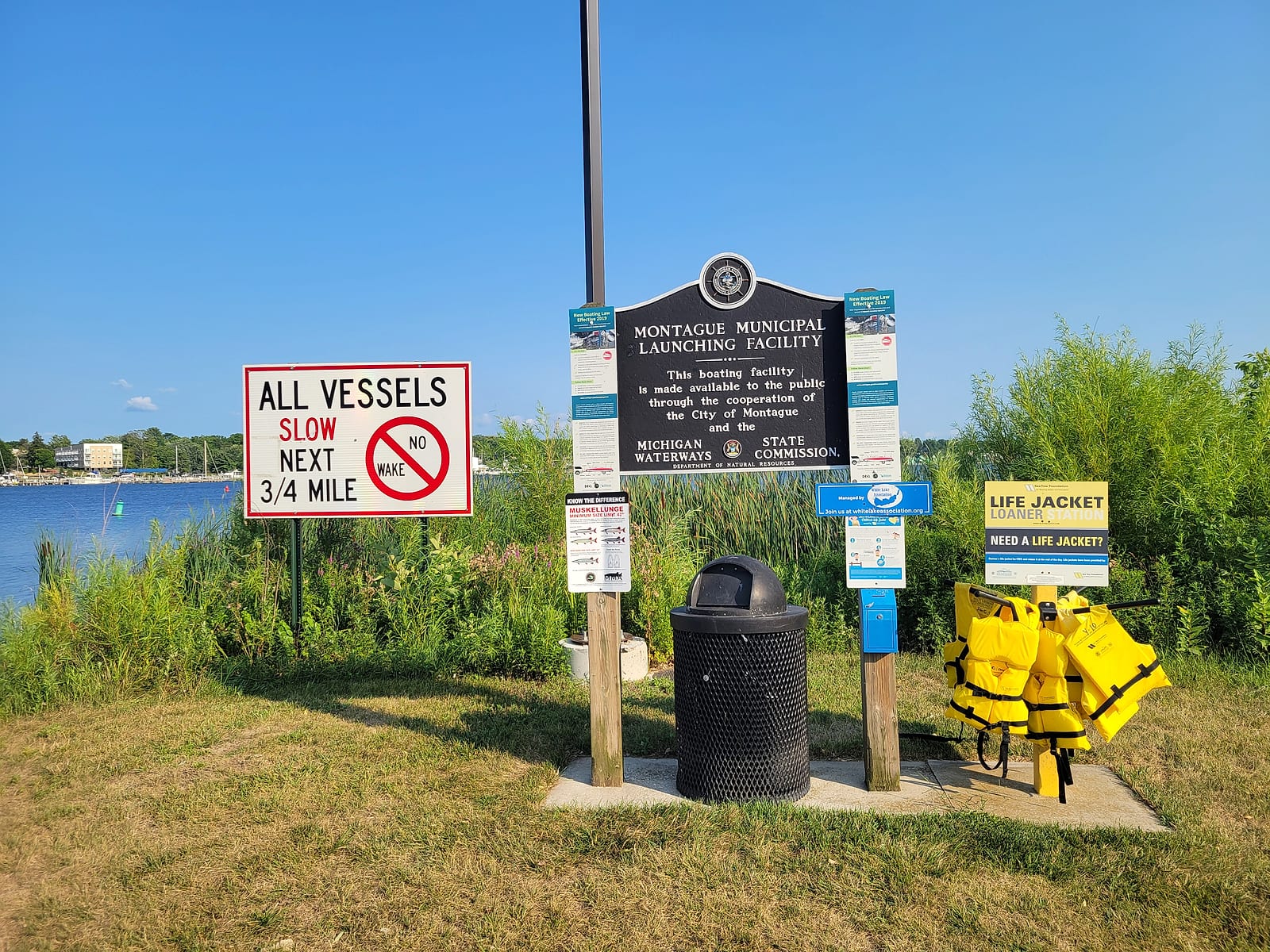
The Montague Municipal Boat Launch from above - three docks, the trailer lot, and the fish-cleaning building - and the signs at the ramp: the city-DNR cooperation plaque, a no-wake notice for the next three-quarters of a mile, a 42-inch muskellunge minimum, and a life-jacket loaner station. July 2026.
If you would rather keep the boat in the water, the White Lake Municipal Marina in Whitehall runs 40 seasonal and 10 transient slips with fuel, pump-out, showers, and power, set in a park a short walk from downtown shops and the summer theatre. That walk works from the water, too: tie up as a transient and downtown Whitehall's restaurants and bars are minutes on foot. The one boat-up meal I know of on this lake is the Eagles club on South Lake Street, which keeps a dock you can pull right up to - it is a membership club, so check before you count on dinner. Slip rates get adopted by council and change; take current numbers from the city's page.
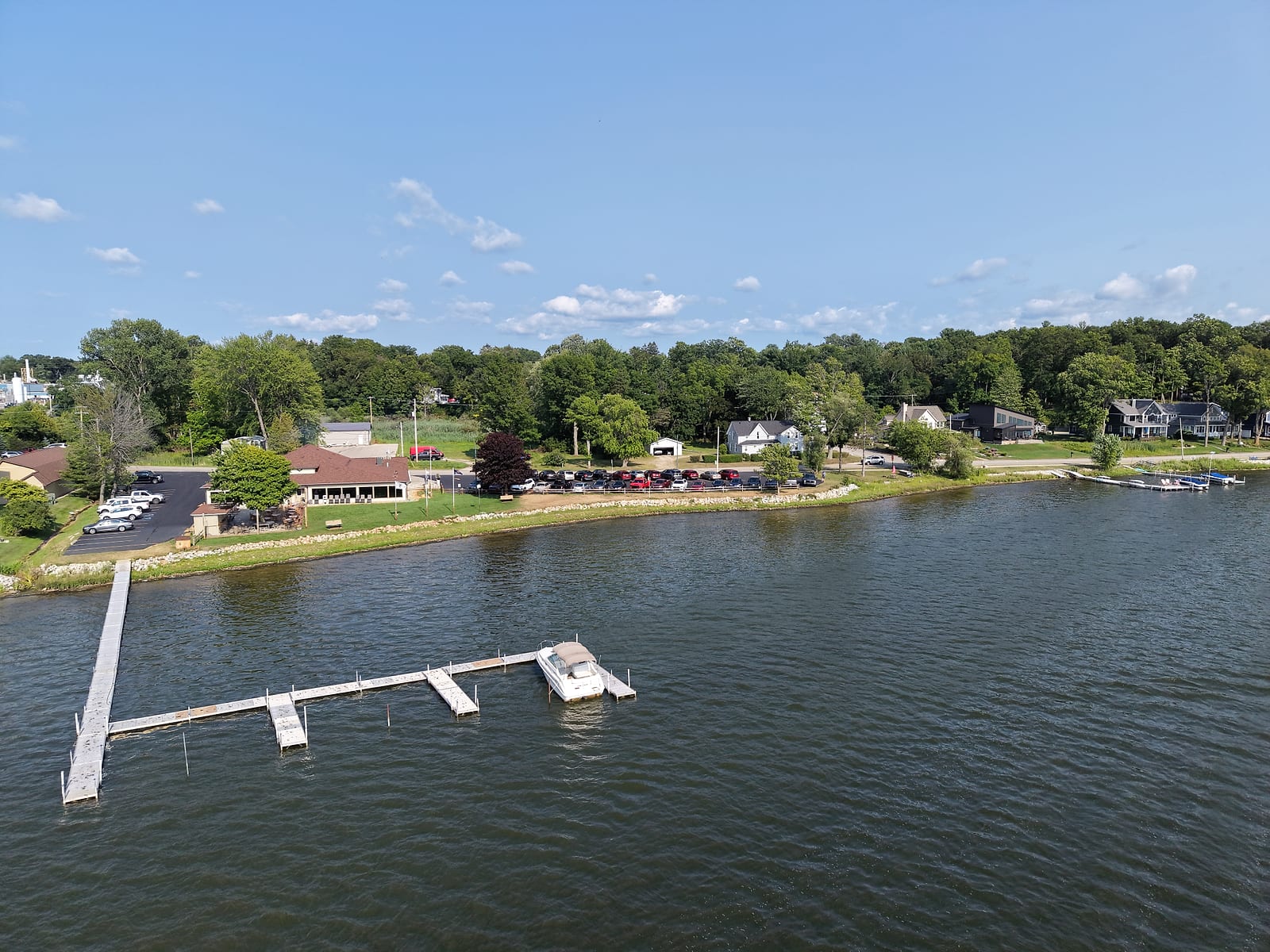
The municipal marina in its park setting, a short walk below downtown Whitehall, and the Eagles club dock from the water side on a full July evening - the boat-up meal, if the club's rules work for you. July 2026.
Fishing, and the Shanty Town
The DNR surveyed White Lake in 2023 and published the results in its 2024 status of the fishery report. Their nets turned up 37 species. Panfish are the headline: bluegill and pumpkinseed were both growing faster than the state average, with fish reaching the seven and eight-inch classes, and the DNR's bluegill index rated the 2023 catch good where the 2007 survey had rated very poor. Yellow perch carry a long reputation here, and the report describes two populations mixing - resident fish plus larger, paler migrants that come in from Lake Michigan, which anglers were catching just inside the channel while the crews worked.
Bass tournaments run heavy here: the DNR counted 208 of them between 2016 and 2022, with better than 20,000 bass reported caught. Northern pike grow well here, and the report says the lake is known as an excellent pike fishery, particularly through the ice in winter. That matches what I remember: White Lake becomes a shanty town in winter, the same as the lakes down our way. Muskellunge have been stocked since 2013 and are being caught, and the 2023 crews netted an 18-inch lake sturgeon, the first one ever recorded in a White Lake survey. Walleye are the sore spot, and the DNR says so plainly: nine fish in the 2023 nets against 54 in 2007. The report adds that in recent years the stocked walleye do not seem to be surviving the way they once did.
Before You Eat Your Catch
Michigan's health department still publishes consumption guidance for White Lake, delisting or not. Check the current Michigan Eat Safe Fish guide (Find Your Area, then White Lake - the state lists this lake by name) before keeping fish. Our fishing guide explains how the advisories work and why they exist.
What the Water Is Actually Like
The lake is not uniform, and the difference matters if you are looking at addresses. The upper end, up where Dowling Street crosses the White River and the bike trail crosses it too, is mucky. That end is soft-bottomed and weedy, and when the water drops it gets considerably muckier. The DNR describes the same thing from the survey side: organic muck substrate through the upper portion, with heavy aquatic plant growth near the river mouth, while the rest of the lake bottom runs to sand and gravel.
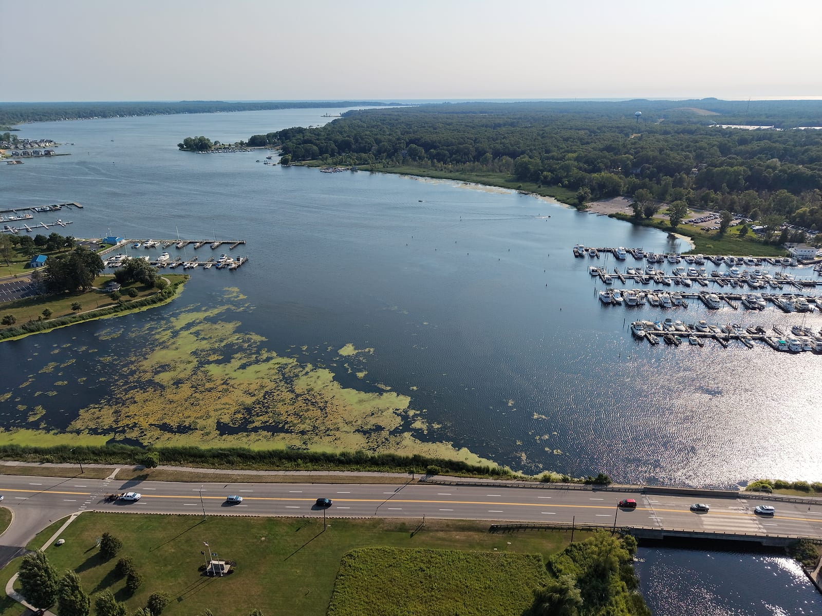
Water level here is not a local matter either. Because the lake connects straight to Lake Michigan, its level rises and falls with the big lake, so a shoreline that looks generous in a low-water year can be a different property in a high one. The shoreline is also worked hard: the DNR's 2023 shoreline pass found armoring along 51.3% of the lake, close to double what it measures on comparable large, deep Michigan lakes, with roughly 15 docks and 16 houses per kilometer. Undeveloped natural shoreline is the scarce thing on White Lake.
The water here also gets measured by the people who live on it. The White Lake Association's volunteer testing archive tracks clarity, phosphorus, and oxygen at both ends of the lake through the Cooperative Lakes Monitoring Program, with reports reaching back more than a decade. The raw station records are public on the state program's data portal, with samples still going in as of July 2026. The association runs a seasonal data buoy with live readings and keeps a webcam at the light station. If you want to know what the water has been doing, year by year, that archive is the place to read.
The Cleanup: What Happened and Where It Landed
I remember the tannery and the pollution myself. White Lake was declared a Great Lakes Area of Concern in 1987, and the EPA's account lists the causes: chemical manufacturing, waste disposal, municipal wastewater, and tannery operations, which left contaminated groundwater, heavy metals in the sediment, and too many nutrients. A 1994 assessment found arsenic, chromium, and mercury in the sediments beside the old leather works in an area still called Tannery Bay.
Then they fixed it. More than 100,000 cubic yards of contaminated sediment came out of the lake, over 50 acres of wetland and nearshore habitat were rebuilt, and all eight of the listed impairments were cleared between 2011 and 2014. On October 30, 2014, the EPA announced that White Lake was off the international list of Areas of Concern. Today housing stands on ground that used to be the problem - a strange thing to see if you knew that shore before, the way I did.
Delisted does not mean untouched, and the state does not pretend otherwise: Michigan's health department still carries fish-consumption guidance for the lake. If you are looking at a property on or near remediated industrial ground, the useful move is to read the record instead of taking the story secondhand, in either direction. The EGLE delisting file holds the lake-wide cleanup record; what happened on a specific parcel is its own question, worth asking directly in due diligence.
Two Towns, One Lake
The character of a lake gets set by the towns around it, and White Lake has two of them looking at each other across the water. Montague bills itself as home of the world's largest weathervane, and it is worth a stop whatever you make of the superlative. The area visitors bureau puts it at 48 feet high and 4,300 pounds of hand-forged aluminum at Dowling and Water, with a working weather station in its base. What sits on top is the better story: a model of the Ella Ellenwood, a lumber schooner that worked out of White Lake. She ran aground eight miles north of Milwaukee in October 1901 and broke apart in a fall storm. The next spring a piece of her nameboard washed up in White Lake, having drifted back across the lake to her home port, and it is still displayed in Montague City Hall.
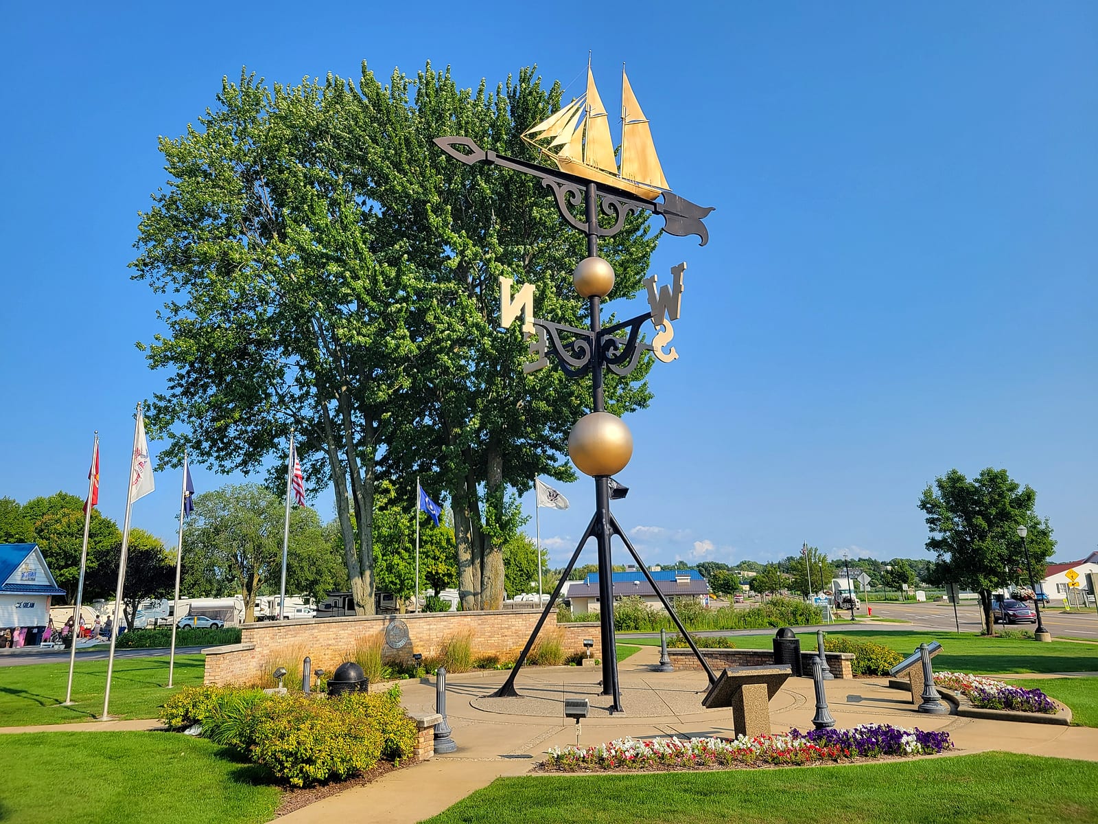
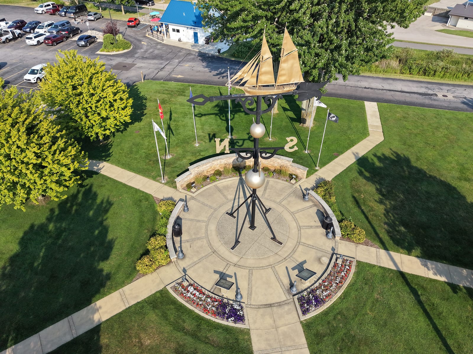
The weathervane at Dowling and Water from the sidewalk, and the Ella Ellenwood from straight above - an angle the ground never gives you. July 2026.
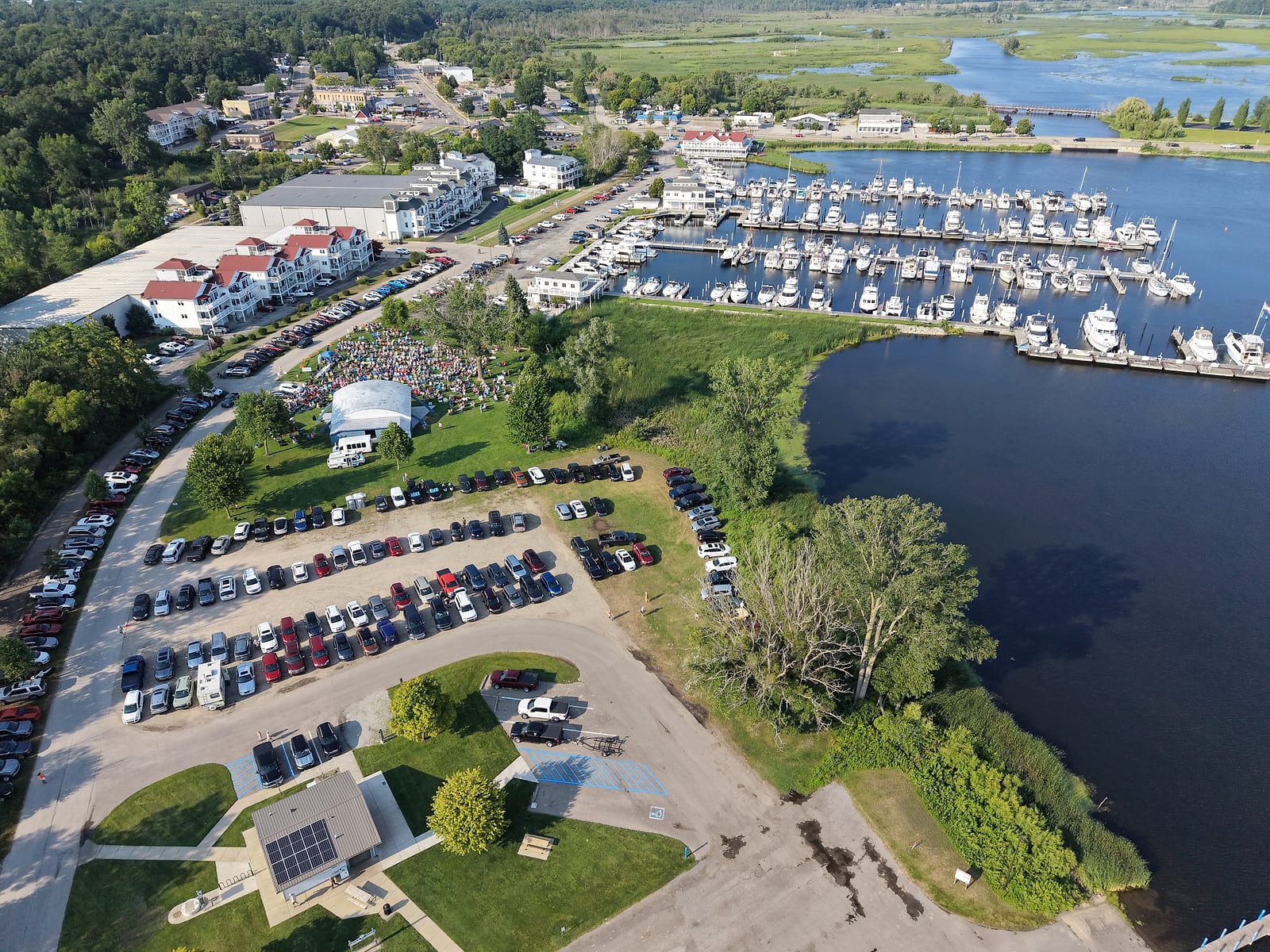
Concert night at the Montague band shell, July 2026 - Magic Bus on the stage, the lawn and the lots full, and the municipal marina right behind. The turnout is the town in one picture.
The old rail line left the towns a pair of trestles I have always liked. On South Lake Street in Whitehall, cars take turns passing one at a time under a 1930 trestle - wooden bents carrying a steel span, with the bike trail running across the top. Up by the old Dog 'n Suds corner, a second low trestle carries the path over the White River toward Montague. The Fred Meijer Berry Junction Trail rides an old rail grade for its northern seven miles, then hands off to the White Lake Pathway, which carries riders through Whitehall, over that river trestle, and on toward Montague and the Hart-Montague Trail. You can ride here from the Muskegon Lake Nature Preserve on pavement the whole way, off the roads except at a handful of crossings.
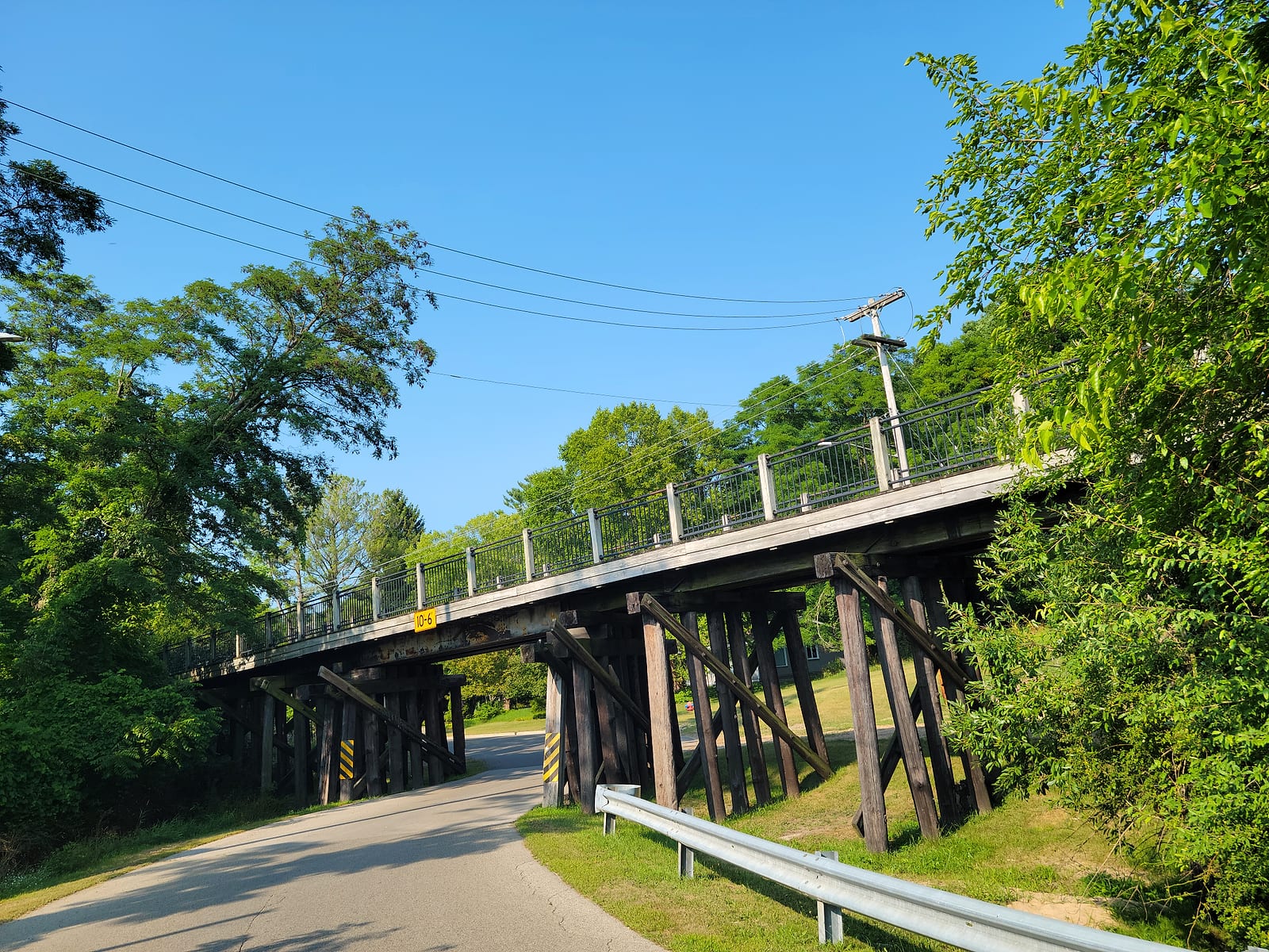
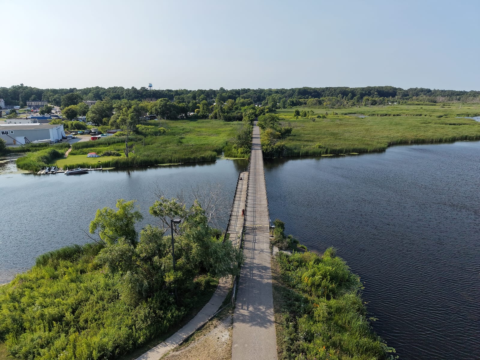
The pair: the Lake Street trestle with its one-lane squeeze and posted 10-foot-6 clearance, and the Pathway's crossing over the White River by the old Dog 'n Suds corner. July 2026.
The rhythm of the year is the thing to understand before you buy. Whitehall fills up in summer with people from Chicago and elsewhere who come for the water, and it empties out after that. I liked the empty part: no wait at the restaurants, better service, nobody rushing you. If a buzzing summer town is what you are picturing year-round, this lake will surprise you in January. If a slow winter sounds like the point, that is exactly the part I liked.
Is White Lake Right for You?
I will give you my own read, since I have lived on both. For the water itself I would take Muskegon Lake: more room to run, more open water, and a channel built for freighters. What White Lake has that Muskegon Lake cannot match is the small-town feel of two little cities sharing one lake. Weigh what you are actually buying - a boating lake, or a town you want to belong to.
On price, my read starts in the years when Muskegon smelled like the paper mill - before the mill closed and a roughly $85 million cleanup and restoration remade Muskegon Lake. Nobody wanted to be on Muskegon Lake then; White Lake, Bear Lake, and Mona Lake were the lakes you went to, and they priced accordingly. The mill is gone now, the coal plant came off the skyline, and to my eye Muskegon Lake came out of it all as the best lake of the group - the waterfront transformation guide tells that story. But the old premium on the other lakes never reset, and Muskegon Lake prices have been climbing to catch up. That, I believe, is why a White Lake listing still tends to read higher.
Two specifics worth carrying into a search. First, a number of the cottages on this lake were built for summer and have sold for serious money anyway; charming in July is not the same as heated, insulated, and plumbed for January, so confirm the systems and the winter road access before you assume four-season use. Second, up toward the Lake Michigan end there are condos built high on the dune ground with views of both waters at once.
Keep in mind that this is a separate market from Muskegon, with its own schools, its own city halls, and its own tax picture. The waterfront property tax comparison includes the Montague and Whitehall-area lines for a first look, and the relocation checklist covers the practical side of moving onto any waterfront around here.
One caution before you fall for a specific White Lake address: a lake whose level follows Lake Michigan, with a soft upper end and a heavily armored shoreline, behaves differently across high-water and low-water years, and a calm afternoon showing will not tell you which one you are looking at. The waterfront flooding and hidden-risks guide walks through how to check an exact address for high-water and shoreline exposure, the kind of thing listings and sellers tend to leave out.
Common Questions About White Lake
Where is White Lake in Michigan?
This White Lake is in Muskegon County, about twenty minutes up the coast from Muskegon, with Whitehall on its south shore and Montague on its north. It is fed by the White River and opens to Lake Michigan through a short channel at its west end. Michigan has another White Lake in Oakland County near Detroit, and a White Lake Township to go with it; that is a different lake several hours east, so the Whitehall and Montague names are the ones to search on if you mean this one.
Can you get from White Lake to Lake Michigan by boat?
Yes - it is one of the lake's defining advantages. A federally maintained channel about a third of a mile long runs from the west end out between two piers to the big water, and the Army Corps operates it as a recreational harbor, with dredging that targets a 12-foot depth; Mona Lake's channel, for comparison, is a small-boat squeeze. I ran boats and jetskis through it for years, between the cottage and our Muskegon Lake dock. The part to plan around is Lake Michigan itself - pick your weather for the open leg.
How deep is White Lake?
The Michigan DNR's 2024 fishery report puts the maximum at roughly 70 feet, with an average depth of about 23 feet across the lake's 2,571 acres. It runs about five and a half miles end to end and averages a mile across. Those are lake-wide figures: up at the river end the DNR's survey notes muck bottom and heavy plant growth, a different kind of water from the sand-and-gravel body of the lake.
Is White Lake clean now?
It is dramatically better than it was. White Lake spent 1987 to 2014 on the Great Lakes list of Areas of Concern over tannery and chemical-plant contamination, and it earned its way off through years of sediment removal and habitat restoration; the EPA made the delisting official in October 2014. It is not a blank slate, though: Michigan's health department still publishes fish-consumption guidance for this lake, so check the current Eat Safe Fish guide before you keep a catch.
Where can you launch a boat on White Lake?
The Montague Municipal Boat Launch at the upper end is the main one, and the DNR calls it the primary launch on the lake, with parking for about 60 rigs and a fish-cleaning station. Montague sells annual permits only, with no daily option, so a visiting trailer boater needs to plan for that. Two much smaller ramps sit farther down the lake, at Scenic Road on the south side and Lau Road on the north, each with room for only a few vehicles and trailers. Whitehall's municipal marina rents seasonal and transient slips if you would rather leave the boat in the water.
What is White Lake like in winter?
Quiet, and for some people that is the selling point. The summer crowd goes home in the fall, the restaurants stop running a wait, and once the ice sets up the lake grows its shanty town - the DNR's report notes the lake's reputation for northern pike through the ice. The flip side: a number of the cottages here were built for summer only. Anything marketed as seasonal needs its heat, insulation, plumbing, and winter road access checked before you count on living in it year-round.
Sources
- Michigan DNR, Status of the Fishery Resource Report 2024-360 (White Lake) - the 2023 survey: lake dimensions and depth, substrate, launches and shore access, the species results, shoreline armoring, and the walleye decline
- Michigan EGLE, White Lake AOC (delisted) - the 2,571-acre drowned river mouth description, the federally maintained channel, and the October 30, 2014 delisting
- U.S. Army Corps of Engineers, White Lake Harbor fact sheet - the recreational-harbor classification, the 12-foot maintenance depth and five-year dredging cycle, and the harbor-of-refuge role
- 33 CFR 162.120, Harbors on Lake Michigan - the 8-mph cap on vessels over 40 feet, posted on the sign at the channel
- U.S. EPA, White Lake AOC (delisted) - the 1987 designation and its causes, the sediment and habitat work, and the impairment removals
- Michigan MDHHS, Eat Safe Fish: White Lake - current fish-consumption guidance for the lake
- City of Whitehall, White Lake Municipal Marina - slip counts, amenities, season, and the city's own description of the channel
- City of Montague, Municipal Boat Launch - the ramp and fish-cleaning station, and the annual-permit rules
- White Lake Area Chamber and Visitors Bureau - the weathervane's dimensions and the Ella Ellenwood nameboard story
- Lakeshore Keepers, White River Light Station - the 1870 channel, the 1875 light station, and its keepers
- White Lake Association - the volunteer CLMP testing archive, plant surveys, the no-wake buoys, and the seasonal data buoy and light-station webcam
- MiCorps CLMP data portal - the state monitoring program's public records for the lake's East and West stations
- Fruitland Township Master Plan (PDF) - the lake's old natural outlet, about a mile north of the present channel
- White Lake Yacht Club racing calendar - the summer weekend fleet schedule
Related Guides
Muskegon Lake
The bigger lake to the south, with a freighter channel and far more open water to run in.
Read the Muskegon Lake guideLake Michigan Shoreline
The open coast the White Lake channel opens onto, and how to read it before you run it.
Read the Lake Michigan guideBerry Junction Trail
The paved lake-to-lake ride from Muskegon Lake up to White Lake at Whitehall.
Read the trail guideMona Lake
The other drowned river mouth lake nearby, with a much smaller channel to the big lake.
Read the Mona Lake guideDuck Lake
The quiet lake just south along Scenic Drive, beside a day-use state park, where the outlet to Lake Michigan is a stream for swimmers, not a channel for boats.
Read the Duck Lake guideAbout this guide
Written by James Maurer, a retired municipal employee with 25 years in West Michigan local government and a lifetime on these lakes.